- Getting Started
- Administration Guide
-
User Guide
- An Introduction to Wyn Enterprise
- Document Portal for End Users
- Data Governance and Modeling
- Working with Resources
- Working with Reports
-
Working with Dashboards
- Dashboard Designer
- Selecting a Dataset
- Data Attributes
- Dashboard Scenarios
- Dashboard Templates
- Component Templates
- 3D Scene
- Explorer
- Visualization Wizard
- Data Analysis and Interactivity
- Dashboard Appearance
- Preview Dashboard
- Export Dashboard
- Dashboard Lite Viewer
- Using Dashboard Designer
- Animating Dashboard Components
- Document Binder
- Dashboard Insights
- View and Manage Documents
- Understanding Wyn Analytical Expressions
- Section 508 Compliance
- Subscribe to RSS Feed for Wyn Builds Site
- Developer Guide
Modify Geographic Data
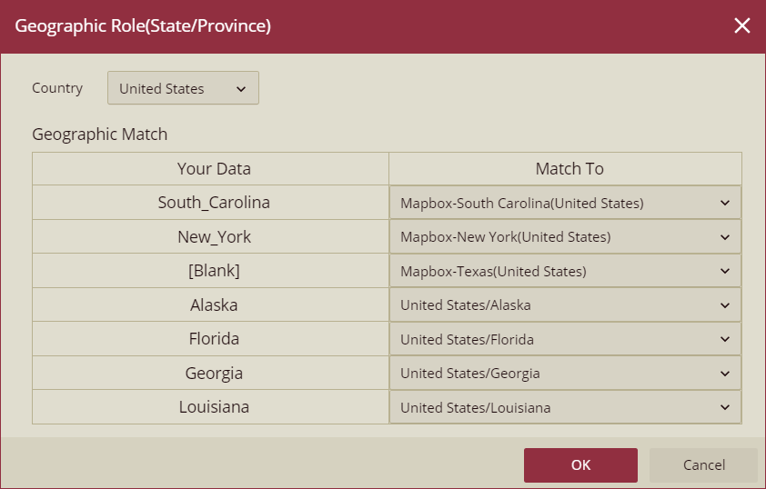
You can modify the geographic data of a data source or dataset including the City, State, and Country using the Edit Geographic option on the data binding panel of the dashboard designer. You can also use Mapbox's search capability to search longitudes and latitudes to modify the geographic data.
Note: The Search from Mapbox option is visible only when the Use Mapbox flag is set to On from the Admin portal.
Follow the steps below,
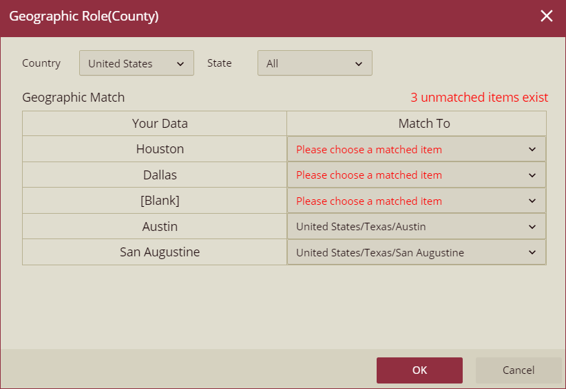
Navigate to the Data Binding panel, select the map scenario, and click the settings icon next to the geographic data field of the selected dataset. The Geographic Role popup will appear on your screen.
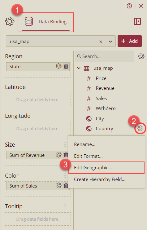
The Geographic Role popup will vary for the City, State, and Country data as explained below.
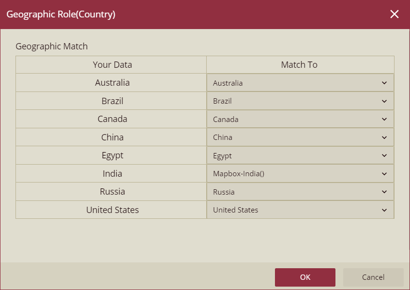
Country: For the country data, existing geographic data will appear in the Your Data column and you can select the value to match from the Match To column. Click Ok to save.
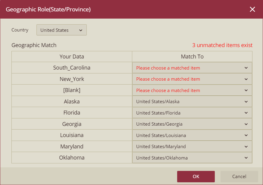
State: For the state data, the Country dropdown will display the list of available countries in your dataset. The existing geographic data will appear in the Your Data column and you can select the value to match from the Match To column. Click Ok to save.
City: For the city data, the Country dropdown will display the countries and the State dropdown will display the states available in your dataset. The existing geographic data will appear in the Your Data column and you can select the value to match from the Match To column. Click Ok to save.
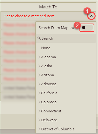
You can also use the Search From Mapbox option to look up addresses and string values to plot points on maps. Click the arrow button in the Match To column and turn on the Search From Mapbox flag.
Search the address and select from the search results to apply.
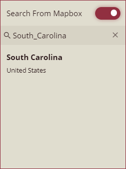
The selected Mapbox address will appear in the Match To column.
